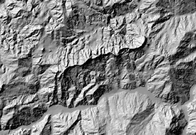
A DEM map meaning Digital Elevation Model. This one shown is a digital elevation picture of Valestra, Northern Apennines in Italy. As you look at the image it easily defines the elevated areas and then the valleys or lowlands as this style of mapping is good for. The images are normally created by satellites.
No comments:
Post a Comment