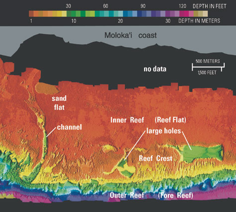
A Lidar is a type of Laser mapping. The laser part of it is used to produce images like this one of a coral reef. Often used for terrain mapping which you could say this is because it is still seeing elevations and changes in land structure. This method of mapping is extremely accurate. As you can see from the LIDAR image of the reef it shows you the low spots and holes in the reef very interesting and helpful.
No comments:
Post a Comment