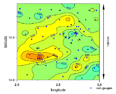
In a Isohyet this is a layout diagram to show an areas precipitation. Like this map you can see lines and numbers. As you look more in depth on this map the lines are defined by numbers showing the rainfall for a particular area for instance this one is of Arizona. These maps are often color coded much like this one making the areas of rainfall defined in color by their amounts.
No comments:
Post a Comment